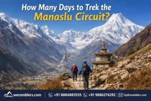
Manaslu Circuit Trek Distance Guide: Route, Elevation & Day-by-Day Breakdown
The Manaslu Circuit Trek is one of the most captivating high-altitude adventures in Nepal, winding through lush river valleys, remote mountain villages, ancient monasteries, and over the majestic Larkya La Pass. Unlike the commercialized Annapurna and Everest routes, this trek offers raw Himalayan beauty and authentic cultural immersion, making it a favorite among seasoned trekkers seeking less-trodden paths.
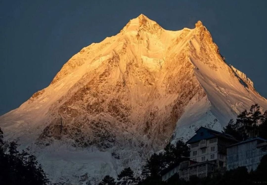
With an average duration of 13 days, the Manaslu Circuit Trek distance spans approximately 177 kilometers on foot, weaving through elevations ranging from 870 meters at Machha Khola to a staggering 5,106 meters at Larkya La Pass. This trail is not just about distance, it’s a journey through shifting ecosystems, ethnic diversity, and the shadow of the world’s eighth-highest peak, Mt. Manaslu (8,163 meters).
Manaslu Circuit Trek Overview
The Manaslu Circuit Trek circles the Manaslu massif in west-central Nepal, near the Tibetan border. Starting in Machha Khola and ending in Tilije/Besisahar, the route takes you through the remote Gorkha district, where trails meander past cascading waterfalls, terraced fields, ancient gompas, and yak pastures. Culturally, it transitions from the Hindu mid-hills to the Tibetan-influenced highlands, offering rich local experiences.
Trekkers often consider it a quieter alternative to the Annapurna Circuit with similar scenic rewards. You’ll pass through Manaslu Conservation Area, home to snow leopards, blue sheep, Himalayan Tahr, and over 1,500 species of flora.
How Long Is Manaslu Circuit Trek?
The total Manaslu Circuit trek length is roughly 177 kilometers, depending on slight variations in the route or side excursions. On average, trekkers walk 15–20 kilometers per day, balancing gradual ascents with adequate acclimatization.
This challenging yet rewarding trek is best completed in 13 to 15 days, with careful attention to elevation gain to prevent altitude sickness. The driving distances at the beginning and end (Kathmandu to Machha Khola and Besisahar to Kathmandu); add another 335 kilometers by road.
Elevation and Major Highlights on Manaslu Circuit Trek
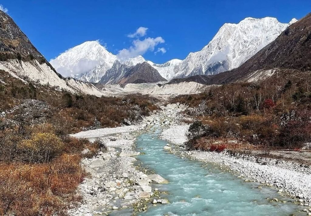
The Manaslu Circuit Trek elevation profile is characterized by gradual climbs followed by steep ascents to Larkya La Pass, the trek’s highest point at 5,106 meters. Starting from 870 meters at Machha Khola, the trail progressively rises through sub-tropical valleys, temperate forests, alpine meadows, and finally, to snow-covered highlands.
Major elevation highlights include:
- Samagaon (3,500 m): A vital acclimatization stop with panoramic views of Mt. Manaslu and ancient monasteries.
- Samdo (3,850 m): The last Tibetan village before the pass.
- Larkya La Pass (5,106 m): A dramatic crossing offering spectacular views of Himlung, Cheo, Kang Guru, and Annapurna II.
- Bhimtang (3,720 m): A scenic alpine valley surrounded by glacial moraines.
Daily Distances Hiked During the Manaslu Circuit Trek
Day 1: Arrival in Kathmandu
Altitude: 1,400 meters / 4,593 feet
Your journey begins in the bustling capital city of Nepal. While there’s no trekking today, this day is crucial for final permit preparations, gear checks, and adjusting to the altitude before heading into the Himalayas. Kathmandu also offers cultural gems like Swayambhunath and Boudhanath for those arriving early.
Day 2: Drive to Machha Khola
Altitude: 870 meters / 2,854 feet
Distance: 160 kilometers by road
Duration: 8 hours
Today, you drive from Kathmandu to Machha Khola, the starting point of your trek. The scenic ride passes through the Trishuli River Valley, small towns like Arughat, and rolling hills before reaching this small riverside village. The drive gives a preview of rural Nepal and introduces you to the remoteness of the Manaslu region.
Day 3: Machha Khola to Jagat
Altitude: 1,410 meters / 4,626 feet
Distance: 22 kilometers
Trekking Duration: 8–9 hours
This first trekking day takes you through dense forest trails, suspension bridges, and small settlements like Tatopani (famous for its hot springs). The trail is a mix of gentle ascents and steep climbs, eventually arriving at Jagat, a stone-paved village where your Manaslu Conservation Area permits are checked.
Day 4: Jagat to Deng
Altitude: 2,095 meters / 6,873 feet
Distance: 20 kilometers
Trekking Duration: 7–8 hours
Climbing gradually, the trail winds through lush subtropical forests and crosses the Budhi Gandaki River multiple times. Expect traditional stone villages like Sirdibas and Philim, followed by narrow gorges and bamboo groves before reaching Deng, a small settlement marking the cultural transition to the Tibetan-influenced highlands.
Day 5: Deng to Namrung
Altitude: 2,900 meters / 9,514 feet
Distance: 19 kilometers
Trekking Duration: 6–7 hours
The trail continues through alpine terrain with pine forests and rhododendrons. You’ll pass through Ghap and climb gradually toward Namrung, a well-developed village offering excellent views of Ganesh Himal and Siringi Himal. Namrung also has traditional Tibetan-style houses and prayer flags flapping in the wind.
Day 6: Namrung to Samagaon
Altitude: 3,500 meters / 11,483 feet
Distance: 17 kilometers
Trekking Duration: 6–7 hours
Today’s route is a scenic highlight, offering vistas of Mt. Manaslu, Himalchuli, and Ngadi Chuli. You’ll ascend through Lihi, Sho, and Lho, where a 360-degree Himalayan panorama awaits. Arriving at Samagaon, you’re now in the heart of the Nubri Valley, surrounded by glacial landscapes and sacred sites.
Day 7: Acclimatization Day in Samagaon
Altitude: 3,500 meters
Rest and acclimatize to avoid altitude sickness. Popular options include hiking to Manaslu Base Camp (4,800 m) or visiting Pungyen Gompa, both offering stunning views of glaciers and snowfields. This break is essential before heading to higher elevations.
Day 8: Samagaon to Samdo
Altitude: 3,850 meters / 12,631 feet
Distance: 8.5 kilometers
Trekking Duration: 4–5 hours
A shorter trek today, gradually ascending along the Budhi Gandaki River with sweeping valley views. Samdo is a remote Tibetan refugee village near the Nepal-Tibet border and an ideal place for further acclimatization. It’s one of the last settlements before the high mountain pass.
Day 9: Samdo to Dharamshala
Altitude: 4,460 meters / 14,633 feet
Distance: 12 kilometers
Trekking Duration: 5–6 hours
Today, you gain serious altitude. The trail climbs past frozen rivers and yak pastures to Dharamshala, also known as Larkya Phedi, the last stop before crossing the pass. Accommodation here is basic, but the views of Larkya Peak and surrounding glaciers are phenomenal.
Day 10: Dharamsala to Bhimtang via Larkya La Pass
Altitude:
- Larkya La Pass: 5,106 meters / 16,752 feet
- Bhimtang: 3,720 meters / 12,204 feet
Distance: 16 kilometers
Trekking Duration: 9–10 hours
This is the most demanding and rewarding day of the trek. A pre-dawn start takes you across Larkya La, the highest point on the Manaslu Circuit Trek. Expect a long, steady climb through snow and wind, rewarded by panoramic views of Himlung, Kang Guru, and Annapurna II. The descent to Bhimtang is steep and dramatic.
Day 11: Bhimtang to Tilije
Altitude: 2,300 meters / 7,546 feet
Distance: 16 kilometers
Trekking Duration: 6–7 hours
You descend through lush rhododendron forests and alpine meadows, crossing the Dudh Khola river. This section marks your return to greener, more temperate zones. Tilije is a charming Gurung village with stone paths and warm hospitality.
Day 12: Tilije to Besisahar, Drive to Kathmandu
Tilije to Besisahar Distance: 54 kilometers (drive)
Besisahar to Kathmandu Distance: 175 kilometers (drive)
Driving Duration: 9 hours combined
Your trek concludes with a drive from Tilije to Besisahar, then back to Kathmandu. Enjoy the contrast between high mountains and the bustling energy of the city. This is a day to reflect on your incredible accomplishment across the Manaslu Circuit Trek route.
Day 13: Departure from Kathmandu
Your Manaslu Circuit Trek adventure ends. After one final Nepali breakfast, you’ll be transferred to the airport for your onward journey. Carry home stories of high passes, Himalayan culture, and unforgettable landscapes.
Why Choose We Ramblers for Manaslu Circuit Trek
At We Ramblers, we believe that every high-altitude adventure should be thrilling, safe, and deeply memorable. Our expert guides are wilderness-first-aid certified, our itineraries are carefully crafted for acclimatization, and we offer full logistical support, including permit handling, experienced porters, satellite communication, and emergency evacuation protocols.
We specialize in remote, high-altitude Himalayan expeditions and are a trusted partner for international trekkers who expect both adventure and safety. Contact us today for detailed information about the Manaslu Circuit Trek.
Frequently Asked Questions
1. Is Manaslu Circuit trek hard?
Yes, it’s considered moderately to highly challenging due to high altitude and rugged terrain.
2. What level is Manaslu Circuit trek?
It’s a strenuous trek, suitable for experienced trekkers or fit adventurers.
3. Is the Manaslu Circuit harder than the Everest Base Camp?
Yes, generally harder than EBC due to remoteness, steeper trails, and less infrastructure.
4. Can a beginner climb Manaslu?
Climbing Mount Manaslu (8,163m) is not for beginners—it’s a technical 8000m peak. But the Manaslu Circuit trek can be done by fit beginners with proper preparation and guidance.