Distance Between the Places During Annapurna Circuit Trek
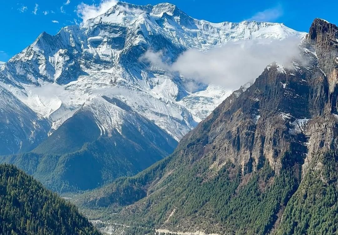
The Annapurna Circuit Trek is one of the most iconic long-distance trekking routes in the world, circling the majestic Annapurna Massif in Nepal. This legendary journey takes you through a stunning variety of landscapes, from lush subtropical forests and terraced farmlands to high alpine terrain and the dramatic, windswept plateaus of the trans-Himalayan region. The trek offers deep cultural immersion, passing through Gurung, Thakali, and Tibetan-influenced villages, all while providing close-up views of Himalayan giants like Annapurna I (8,091 m), Dhaulagiri (8,167 m), and Machapuchare (6,993 m).
Spanning multiple ecological zones, the Annapurna Circuit Trek route is renowned for its diversity in scenery, culture, and altitude. With carefully paced acclimatization days and detours to places like Tilicho Lake, this trek delivers not just physical adventure, but also spiritual rejuvenation. Whether you’re a first-time Himalayan trekker or a seasoned high-altitude adventurer, this route is a complete package.
How Long Is Annapurna Circuit Trek?
The classic Annapurna Circuit Trek length ranges between 160 to 230 kilometers depending on the route variations and transport options chosen. With road access extending into deeper parts of the trail, many trekkers begin the actual trekking from Chame or Besisahar and end at Jomsom or Tatopani. Including side trips like Tilicho Lake, the total trekking distance and duration vary. In this itinerary, the total walking distance covers approximately 120–130 kilometers, with an overall trip span of 16 days including drives and acclimatization.
Elevation and Major Highlights on Annapurna Circuit Trek
The Annapurna Circuit Trek elevation ranges from 760 m in Besisahar to 5,416 m at Thorong La Pass, the highest point on the route. This massive gain in altitude over the span of two weeks allows for gradual acclimatization, reducing the risk of altitude sickness. Highlights along the trek include:
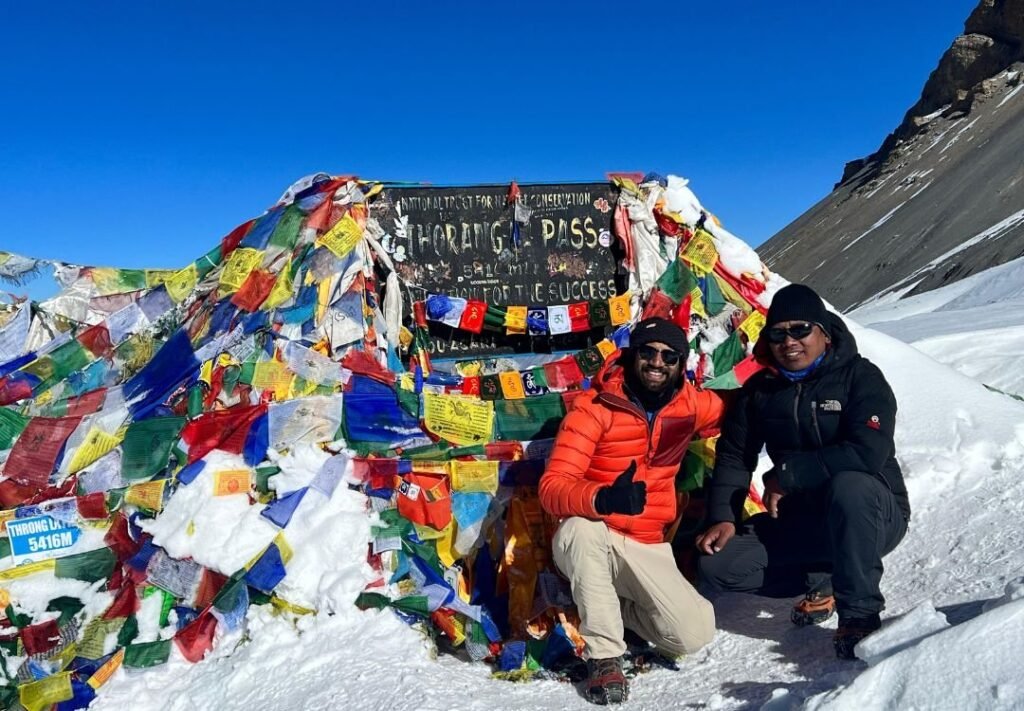
- Crossing the formidable Thorong La Pass (5,416 m)
- Visiting sacred Muktinath Temple
- Exploring the serene Tilicho Lake (4,919 m), one of the world’s highest lakes
- Passing through picturesque villages like Manang, Pisang, and Chame
- Experiencing stark transitions from green hills to desert-like Mustang valleys
Each location along the trek has its own significance, both geographically and culturally, making the Annapurna Circuit Trek a true Himalayan epic.
Daily Distances Hiked During the Annapurna Circuit Trek
Day 1: Arrival in Kathmandu
At an altitude of 1,400 m (4,593 ft), Kathmandu serves as the gateway to the Annapurna region. You’ll arrive in the bustling capital and prepare for the trek ahead. No trekking today; just rest, gear check, and exploration.
Day 2: Kathmandu to Besisahar
The journey begins with a scenic 175 km drive to Besisahar (760 m / 2,493 ft), the traditional starting point of the Annapurna Circuit Trek route. The 5–6 hour drive takes you through riverside towns and green hills. Besisahar is the administrative center of Lamjung District and serves as the first checkpoint for permits and supplies.
Day 3: Besisahar to Chame
Driving deeper into the mountains, you’ll travel 68 km to Chame (2,650 m / 8,694 ft). This route cuts down several days of early trekking on dirt roads. The 4–5 hour jeep ride passes through villages like Jagat and Dharapani, offering glimpses of waterfalls and cliffside trails. Chame is the headquarters of Manang District and the trek officially starts here for many.
Day 4: Chame to Upper Pisang
This is the first day of trekking, covering 14 km over 5–6 hours. As you ascend to Upper Pisang (3,300 m / 10,827 ft), pine forests open into arid valleys. The trail offers spectacular views of Lamjung Himal and Annapurna II. Upper Pisang offers a better vantage and acclimatization over the lower alternative.
Day 5: Upper Pisang to Manang
A 15.5 km trek that takes 6–7 hours leads you to Manang (3,519 m / 11,545 ft). This is one of the most scenic stretches of the Annapurna Circuit Trek. The high route via Ghyaru and Ngawal provides incredible views of the Annapurna range. Manang is a lively acclimatization village with bakeries, lodges, and even a Himalayan Rescue Association clinic.
Day 6: Acclimatization Day in Manang
Rest day for altitude adaptation. Options include short hikes to Gangapurna Lake, Bojo Gumba, or the viewpoint above the village. Staying at 3,500+ meters helps your body adjust for higher ascents ahead on the Annapurna Circuit Trek height profile.
Day 7: Manang to Shri Kharka
A shorter day covering 7.5 km in 3–4 hours, the trail heads north to Shri Kharka (4,080 m / 13,386 ft), a quieter stop on the way to Tilicho Lake. This leg offers incredible views of Gangapurna and Tilicho Peak. It’s a gradual climb along a dramatic mountain ridge.
Day 8: Shri Kharka to Tilicho Base Camp
This 6 km stretch takes about 3–4 hours. The trail narrows and becomes more rugged as you approach Tilicho Base Camp (4,150 m / 13,615 ft), nestled beneath steep rock faces. The altitude gain is steady, and the terrain gets more remote. Prepare for colder nights.
Day 9: Tilicho Base Camp to Tilicho Lake and Back
Today is challenging yet rewarding. A 17 km round trip (7–8 hours) takes you to Tilicho Lake (4,919 m / 16,138 ft), one of the highest glacial lakes in the world. The trail is steep and can be snow-covered but the views are ethereal – deep blue waters surrounded by ice walls and high Himalayan peaks.
Day 10: Tilicho Base Camp to Yak Kharka
Descending and reconnecting with the main Annapurna Circuit Trek route, you’ll trek 10 km over 5–6 hours to reach Yak Kharka (4,018 m / 13,182 ft). The trail passes through alpine meadows dotted with yaks, offering a mix of descent and gentle uphill.
Day 11: Yak Kharka to Thorong Phedi
The journey continues with a 6 km trek over 4 hours to Thorong Phedi (4,540 m / 14,895 ft), the base for the next day’s high pass. The altitude becomes more noticeable, and this small settlement serves as a key rest stop before the big ascent.
Day 12: Thorong Phedi to Muktinath via Thorong La Pass
The most demanding day of the trek involves crossing Thorong La Pass (5,416 m / 17,769 ft), the highest point of the Annapurna Circuit Trek. The 15 km trek (7–8 hours) includes a steep climb via Thorong High Camp (4,880 m) before descending to Muktinath (3,710 m). The views from the top are breathtaking—Dhaulagiri, Annapurna, and the Kali Gandaki Valley unfold below.
Day 13: Muktinath to Jomsom
This 22 km day (7–8 hours) descends through Jharkot and Kagbeni to reach Jomsom (2,743 m / 8,999 ft), the district capital of Mustang. The trail moves from the sacred temple complex of Muktinath through arid, dusty landscapes to the wind-blown town of Jomsom, famous for its apple products.
Day 14: Jomsom to Pokhara
From Jomsom, drive or take a flight for the 158 km journey to Pokhara (822 m / 2,697 ft). The 5–6 hour road journey winds down through the Kali Gandaki Gorge. Pokhara welcomes you with comfort, food, and serene lakeside relaxation.
Day 15: Pokhara to Kathmandu
Another 200 km drive (6–7 hours) brings you back to Kathmandu (1,400 m), marking the end of your Annapurna Circuit Trekking journey. The return offers a chance to reflect on the terrain you’ve crossed, from valleys and lakes to high-altitude passes.
Day 16: Departure
With hearts full of memories and cameras full of majestic Himalayan shots, your Annapurna adventure concludes. We’ll transfer you to Tribhuvan International Airport for your onward journey.
Why Choose We Ramblers for Annapurna Circuit Trek
At We Ramblers, safety and experience come first. With years of guiding trekkers across high-altitude Himalayan routes, we provide expert logistics, reliable guides, full permit support, and 24/7 medical and evacuation backup.
Whether it’s your first Himalayan adventure or your tenth, our dedicated team ensures your Annapurna Circuit Trek is safe, enriching, and unforgettable.
Frequently Asked Questions
1. How far is the Annapurna Circuit per day?
On average, you’ll trek 10–20 km per day, depending on altitude and itinerary.
2. How far is Yak Kharka from Thorong Phedi?
The distance is about 6–7 km, taking around 3–4 hours on foot.
3. How fit do I need to be for Annapurna Circuit?
You should have moderate to high fitness, capable of walking 5–7 hours daily with steep ascents at high altitude.
4. How many kilometers is the Annapurna Base Camp Trek?
The trek is approximately 67–115 km round trip, depending on the route you choose. Contact us now to learn about the full itinerary and departure dates.